Final sailing post - the voyage details
This will be my last article about the sailing trip I just went on in – sailing on the yacht Kioni.
Of course navigation was a huge part of what we were doing. As this was the skippers 16th trip down the east coast he was very experienced with bot the conditions and the navigational aspects including the hundres of islands and shoals we had to avoid. We had plenty of charts, a plotter, depth gauges and so on as well as a hand held GPS unit that Hylton brought with him. We used this for night time navigation and also instant navigation on deck without having to go down to the plotter or charts below.
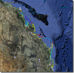
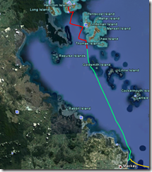
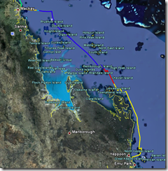
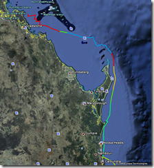
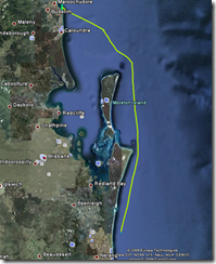
Hylton kindly gave me the GPX track files from the GPS which I converted to Google Earth KMZ files using the GPS Visualiser website.
I have loaded the results into Google Earth and then screen shot using One Note the various legs as well as the whole trip.
For those who want to do this themselves I have included the KMZ files here as attachments. Note there is a little bit missing from one day as we left Yeppoon and also the last little bit into Southport. Total distance sailed was around 680 nautical miles.
| Attachment | Size |
|---|---|
| 1253680877-03647-150.101.179.22.kmz | 24.95 KB |
| 1253681025-03687-150.101.179.22.kmz | 64.08 KB |
| 1253681075-03708-150.101.179.22.kmz | 42.51 KB |
| 1253681133-03717-150.101.179.22.kmz | 78.01 KB |
| 1253681212-03762-150.101.179.22.kmz | 58.09 KB |
| 1253681237-03770-150.101.179.22.kmz | 25.06 KB |




Recent comments
10 years 37 weeks ago
10 years 37 weeks ago
10 years 39 weeks ago
10 years 39 weeks ago
10 years 39 weeks ago
10 years 39 weeks ago
10 years 39 weeks ago
10 years 39 weeks ago
10 years 39 weeks ago
10 years 39 weeks ago